


Nob Hill · San Francisco 170 × 163 × 31 mm · 1,326 buildings · 101 m of relief. Hills that actually rise, and a downtown that breaks the frame.
Overview
BambiMaps is the first Bambi3D studio. Search for a place, drag a box over it and pick a frame, and it builds that patch of the world as a framed relief: OpenStreetMap buildings at their real heights, terrain from AWS Terrain Tiles, streets, water and parks, and your own lettering raised on the rail.
The result is made for printing, not just for looking at. Heights snap to whole layers for your nozzle, landmarks rise through the frame without supports, and a keyhole hanger is recessed into the back (rails under 13 mm get a plain nail hole instead). It exports a Bambu Studio 3MF with each layer on its own AMS slot, or a plain STL for any slicer, with the real plate sizes of the X1 Carbon, X1E, P1S, P1P, A1, A1 mini and H2D built in.
bambimaps.com shows five worked examples (Nob Hill, the Eiffel Tower, the Las Vegas Convention Center, Laguna Seca and Battersea), each rebuilt live in your browser, and a short animated film of the workflow from map to print. The designer itself is in its last stretch of testing behind a launch gate, and pricing hasn't been published.
Highlights
- Real OpenStreetMap building footprints and heights, with tower setbacks
- Terrain from AWS Terrain Tiles, as fine as 1-3 m where lidar exists
- Rectangle, heart or oval frames; six rail profiles and four size presets
- Raised lettering on the rail or a ribbon; the place name is filled in for you
- Heights snap to whole printer layers; details finer than the nozzle are dropped
- 3MF with each layer on its own AMS slot, or a plain STL; keyhole hanger built in
- Built-in plates for Bambu X1 Carbon, X1E, P1S, P1P, A1, A1 mini and H2D
- Five worked examples rebuilt live in the browser
Details
- Platforms
- Web
- Built with
- OpenStreetMap buildings, AWS Terrain Tiles elevation; built in the browser
- Status
- In development
- Requirements
- The STL prints on any printer; the 3MF has real plate sizes for Bambu X1 Carbon, X1E, P1S, P1P, A1, A1 mini and H2D
Questions
Does it work on my printer?
X1 Carbon, X1E, P1S, P1P, A1, A1 mini and H2D are built in, each with its real plate size; if a design won't fit you get a one-click resize. The STL prints on anything.
Can I do a heart, or a ribbon with a name on it?
Yes. Alongside the rectangle there are heart and oval silhouettes, and a heart crops the map rather than stretching it. Any shape can carry a ribbon banner. Terrain relief is rectangles-only; hearts and ovals print flat.
How big can I go?
Anything from a 100 mm coaster to a 300 mm statement piece. Roughly half a kilometre to three kilometres of ground across gives the best-looking prints.
Where does the data come from?
Building footprints and heights from OpenStreetMap, elevation from AWS Terrain Tiles. Google Maps is only the backdrop for picking your area.
Can I use it today?
Not yet. The examples, how it works and ideas are public; the designer is still behind a launch gate. Leave an email on the site to hear the day it opens.
You might also like
See allMore from PyroSoft

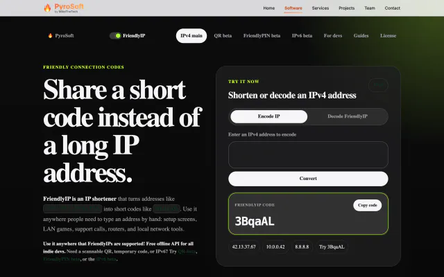


FriendlyIPNetworking · Utilities
Turn IPv4 addresses into six-character codes you can read aloud.
FreeWeb